

Nature's Bounty
Untouched nature in all its splendour is what Uttarakhand offers visitors. The state has been blessed with gorgeous natural beauty. The fact that almost 45.43 per cent of its geographical area has a dense forest cover, makes it all the more remarkable. The state is host to the mighty Himalayas, which guarantee a rich growth of flora and fauna, a pleasant climate and a peaceful and serene environment. The many glaciers here are sources of some of the major rivers of India, including the Ganga and the Yamuna. Snow-covered mountain peaks, like Nanda Devi, Badrinath, and Kamet, offer stunning views, while oak, rhododendron, deodar, and pine forests leave one in awe.
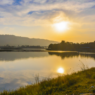
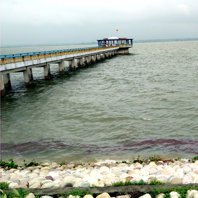
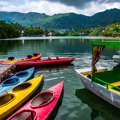
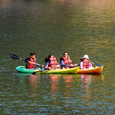
Lakes
Assan Barrage
Assan Barrage is a pristine blue-green lake, located about 40 km from Dehradun. This man-made lake is a birder’s paradise that lies at the confluence of Yamuna and Assan rivers. Almost 53 species of birds can be seen, including red-crested poacher, mallard, coot, pintail, common teal, tufted duck, etc. A bird-watching safari is a must while visiting here. The lake offers splendid boating opportunities. The best time to visit is in October, November, February and March. Assan Barrage is also called Dhalipur Lake.
Bhimtal
Bhimtal is a quaint town, located around 20 km from the hill station of Nainital. It is best known for the Bhimtal lake, which is a glistening emerald pool surrounded by stunning hills and dense forests. Spread over a vast area, Bhimtal Lake is home to diverse aquatic fauna. In winters, it is visited by migratory birds. One of the best ways to explore the lake is by boating. Nal-Damyanti Tal is a serene spot near Bhimtal that is ideal for picnics. Bhimtal is pleasant throughout the year.

Devaria Tal
Devaria Tal or Deorai Tal is a picturesque lake located near Ukhimath. It is perched at an elevation of 2,438 m, and is surrounded by the Garhwal Himalayas and beautiful forests of rhododendron. Devaria Tal is an ideal spot for birders as diverse avifauna can be found here. On a clear day, you can see the majestic Chaukhamba Peak reflected in the waters of the lake.
Hemkund Lake
The pristine Hemkund Lake lies surrounded by seven snow-clad peaks, and nourished by glaciers from Saptrishi peaks and Hathi Parvat. Hemkund Lake lies at a height of 4329 m and is believed to be a pilgrimage site for the Sikhs, along with Gurudwara Hemkund Sahib. A small stream called Himganga emerges from this lake. The best time to visit here is from June to October.
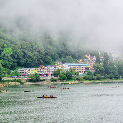
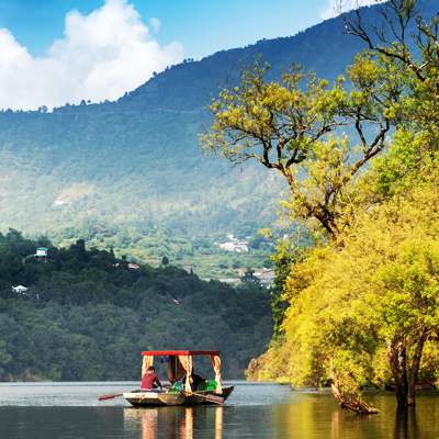
Naini Lake
Naini Lake or Nainital Lake is one of the most important lakes in the Kumaon region. This lunar-shaped freshwater lake was formed from a depression in Nainital due to tectonic movements. It is nourished by fresh streams from the high reaches of the Himalayas. Naini Lake is surrounded by three mountain peaks - Naini Peak on the north-west; Tiffin Top on the south-west; snow-capped peaks on the north. Naini Lake is a tourist hotspot and is one of the best places to enjoy boating. From sail boats and paddle boats to yachts, there is a lot on offer here. The lake is fringed by great accommodation facilities and makes for a great birding spot.
Nanak Sagar
Nanak Sagar is an artificial lake created by a dam built on the Deoha river. It is located in Nanakmatta, one of the religious places of the Sikhs. Nanakmatta is the seat of one of the most important Sikh shrines, Gurudwara Sri Nanakmatta Sahib, which is closely associated with Guru Nanak. The vast Nanak Lake mirrors a plethora of hues of the changing sky. The lake is home to hundreds of avifauna, including the migratory kind. Birders can have an excellent time here.
Naukuchia Tal
One of the most beautiful lakes in Uttarakhand, Naukuchiatal is located in the foothills of Kumaon, at a height of 1,219 m. This nine-cornered lake is only 20 km from Nainital. It is fed by an underwater spring, and surrounded by dense forests of oak. Naukuchiatal shelters abundant and diverse aquatic life and offers tourists a chance to experience nature at its most serene.
Sattal
Sattal is among the most popular tourist destinations in Uttarakhand. Roughly translated, it means seven lakes. It is called so as it was a group of seven lakes interconnected with each other. Sattal lies in the lower ranges of the Himalayas, about 20 km from Nainital. It is a beautiful location, surrounded by dense forests of oak and pine. Adventure-lovers can have a great time here as there are opportunities for trekking, rock climbing, mountain biking, kayaking, angling, river-crossing, rafting, etc.
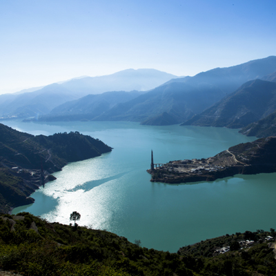
Tehri Lake
Tehri Garhwal is perched at a height of 770 m above sea level. It is known for the popular Tehri Dam, a hydro-electric project centered near Tehri Town. The dam is located on the Bhagirathi river and is said to be the fifth-highest in the world. The nearby Tehri Lake is said to be one of the largest man-made lakes in Asia. Today, the lake is best known for adventure tourism. Visitors can enjoy jet skiing, hot air balloon rides, boating, zorbing, paragliding, hotdog ride, bandwagon boat ride, banana boat ride, etc.
For more information, Click Here
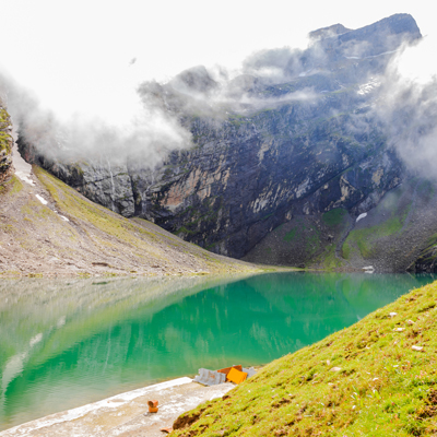
Vasuki Tal
Vasuki Tal is a pristine lake that lies at a height of 4,135 m, a short distance from Kedarnath. It is nourished by water from the snow-clad mountains, and glaciers like the Vasuki Glacier and the Chor Bamak Glacier. Many icebergs float in the lake, and the waters reflect the Kedarnath peaks. The Vasuki Ganga river also originates from this lake. From here, you can get stunning views of Chaukhamba Peak.
Mountain And Glaciers
Bhagirathi Peak
Bhagirathi Peak can be found in the Garhwal Himalayas. It is a group of three peaks, Bhagirathi I (6,856 m), Bhagirathi II (6,512 m), and Bhagirathi III (6,454 m). The highest of these peaks dominates the valley to Gaumukh, which marks the end of the Gangotri Glacier and the origin of the Ganga river. The base camp for mountain expeditions to Bhagirathi is Nandanvan, a beautiful meadow dotted with alpine flora. The best time for expeditions is in the months of May, June and September.
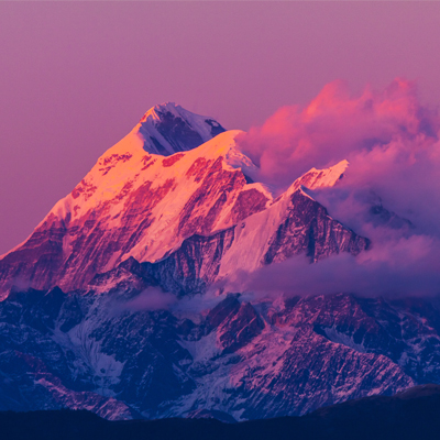
Chandrashila peak
At around 4,000 m, the Chandrashila peak is the summit of the Chandranath Parvat on which the Tungnath temple is located. Chandrashila, literally meaning moon rock, is a majestic peak that offers a stunning panoramic view of the Himalayas, including Nanda Devi, Bandarpunch, Chaukhamba, and Kedar peak. According to legend, Chandrashila is the place where Lord Rama meditated after defeating Ravana. Another lore says that Moon-god or Chandra spent time here in penance. The simple stone temple is atop the peak is dedicated to Goddess Ganga. Chandrashila peak is a steep 1.5 km trek from Tungnath temple, which is around 3.5 km away from Chopta. It's a popular trekking route.
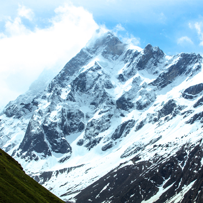
Chaukhamba Peak
Located in the Garhwal Himalayas, Chaukhamba is one of the main mountain massifs in the Gangotri cluster. Roughly translated, it means four pillars, which point to its four majestic peaks. The highest peak, Chaukhamba I, lies on top of the Gangotri Glacier, at a height of 7,138 m. The other three peaks rise to a height of 7,088 m, 6,995 m, and 6,854 m, respectively. The best time for mountaineering expeditions is in June, July, August, and September.
Swargarohini
One of the most impressive peaks of the Garhwal Himalayas, the lofty Swargarohini Peak rises to a height of 6,543 m. Lying in the Bandarpunch range, this massif includes a group of four peaks, Swargarohini I, Swargarohini II, Swargarohini III, Swargarohini IV. Out of all the peaks, Swargarohini I draws the most attention for its dramatic terrain, which makes it look like a two-headed peak. The trek to this peak starts from Badrinath and goes along to the base camp.
Trishul Peak
Trishul is a group of three peaks that lies in Western Kumaon, near the Bageshwar district. Trishul I is the main peak that rises to a height of 7,122 m. It is the first peak to have ever been climbed, back in 1907. Earlier, Trishul was used as a training spot for ski-equipped patrolling officers of the Indo-Tibetan Border Police Force. It is said that in 1958, it took a group of mountaineers around four days to climb the peak and just 90 minutes to ski down to their base camp. The best views of the peak can be seen from Kausani.
Natural Paradise
Flora & Fauna
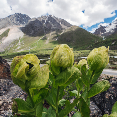
Uttarakhand shelters around 4,000 species of plants, belonging to 1198 genera, under 192 families. Of these, 161 species are recognised as rare or threatened by the International Union for Conservation of Nature. Around 223 species of orchids have been found in North India, and of these, 150 are from Uttarakhand. The state is home to about 102 species of mammals, 623 types of avifauna, 124 varieties of fish, 19 types of amphibians and 69 categories of reptiles. Some of the highly endangered faunae you can find in Uttarakhand are Asian elephant, snow leopard, tiger, musk deer, Himalayan monal, king cobra, bharal, etc. The state has 6 wildlife sanctuaries and 6 national parks. The first national park of India, the Corbett National Park, was established in Uttarakhand in 1936.
Unesco Heritage Site
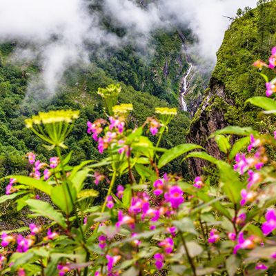
Valley of Flowers
The UNESCO World Heritage Site of Valley of Flowers lies against the backdrop of the majestic Zanskar range. It resembles an artist’s canvas and is flooded with colourful hues. It is surrounded by snow-clad mountains and glaciers, and lies at the conversion point of the Zanskar and the Eastern and the Western Himalayas. The valley comes alive in the months of August and September when thousands of flowers bloom. The best way to explore the valley is via trekking. Cascading waterfalls, sparkling streams, and flowery meadows make the challenging trek rewarding.